Weather Alert in Alaska
Flood Watch issued August 27 at 11:46AM AKDT until August 29 at 12:00PM AKDT by NWS Fairbanks AK
AREAS AFFECTED: Noatak Valley; Lower Koyukuk Valley; Upper Koyukuk Valley
DESCRIPTION: Heavy rainfall that caused rapid rises in headwater streams will continue to cause water level rises on main stem rivers through the end of the week. The Koyukuk River is expected to crest at Allakaket overnight on Wednesday, timing of the Alatna River crest at the confluence with the Koyukuk may be coincident. The Kobuk River is cresting at Kobuk today and may stay high or have another rise through the end of the week due to continued rainfall. * WHAT...Flooding caused by excessive rainfall continues to be possible. * WHERE...Including the following areas, Lower Koyukuk Valley, Noatak Valley and Upper Koyukuk Valley. This includes the cities of Noatak, Red Dog Mine, Huslia, Hughes, Allakaket, Bettles, Evansville, And Alatna. * WHEN...Through Friday evening * IMPACTS...Excessive runoff may result in flooding of rivers, creeks, streams, and other low-lying and flood-prone locations. Area creeks and streams are running high and could flood with more heavy rain. Flooding may occur in poor drainage areas. * ADDITIONAL DETAILS... - Moderate rainfall will continue in the Southern Brooks Range on areas already saturated by heavy rainfall this week. - Http://www.weather.gov/aprfc
INSTRUCTION: Persons living along streams should stay alert and be prepared to take action if a warning or advisory is issued, or flooding is observed. You should monitor later forecasts and be alert for possible Flood Warnings. Those living in areas prone to flooding should be prepared to take action should flooding develop. Stay tuned to further developments by listening to your local radio, television, or NOAA Weather Radio for further information.
Want more detail? Get the Complete 7 Day and Night Detailed Forecast!
Current U.S. National Radar--Current
The Current National Weather Radar is shown below with a UTC Time (subtract 5 hours from UTC to get Eastern Time).

National Weather Forecast--Current
The Current National Weather Forecast and National Weather Map are shown below.

National Weather Forecast for Tomorrow
Tomorrow National Weather Forecast and Tomorrow National Weather Map are show below.

North America Water Vapor (Moisture)
This map shows recent moisture content over North America. Bright and colored areas show high moisture (ie, clouds); brown indicates very little moisture present; black indicates no moisture.

Weather Topic: What is Drizzle?
Home - Education - Precipitation - Drizzle
 Next Topic: Evaporation
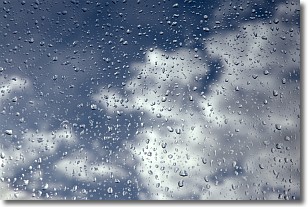
Drizzle is precipitation in the form of water droplets which are
smaller than raindrops.
Drizzle is characterized by fine, gently falling droplets and typically does not
impact human habitation in a negative way. The exception to this is freezing drizzle,
a condition where drizzle freezes immediately upon reaching earth's surface.
Freezing drizzle is still less dangerous than freezing rain, but can
potentially result in hazardous road conditions.
Next Topic: Evaporation
Weather Topic: What is Fog?
Home - Education - Cloud Types - Fog
 Next Topic: Fractus Clouds
Fog is technically a type of stratus cloud, which lies along the
ground and obscures visibility.
It is usually created when humidity in the air condenses into tiny water droplets.
Because of this, some places are more prone to foggy weather, such as regions
close to a body of water.
Fog is similar to mist; both are the appearance of water droplets suspended in
the air, but fog is the term applied to the condition when visibility is less than 1 km.
Next Topic: Fractus Clouds
Current conditions powered by WeatherAPI.com


