Weather Alert in Wisconsin
Ice Storm Warning issued April 2 at 2:54AM CDT until April 2 at 12:00PM CDT by NWS La Crosse WI
AREAS AFFECTED: Taylor; Clark
DESCRIPTION: ...FREEZING RAIN IMPACTS THE AREA THIS MORNING... .Freezing rain will develop overnight and persists into this morning. it will end from south to north through the morning hours. Greatest ice accumulations are forecast along and north of Interstate 94 with icing amounts of a quarter to nearly half an inch possible in a few locations. Closer to Interstate 90, impacts vary more in space and time with ridge tops and bridges possibly seeing more impacts versus the valleys and ground. * WHAT...Significant icing north-central Wisconsin. Additional snow and sleet accumulations up to one inch and ice accumulations between two tenths and three tenths of an inch. Winds gusting as high as 35 mph. * WHERE...Clark and Taylor Counties. * WHEN...Until noon CDT today. * IMPACTS...Power outages and tree damage are likely due to the ice. Travel could be nearly impossible. The hazardous conditions could impact the Thursday morning commute.
INSTRUCTION: Travel is strongly discouraged. If you must travel, keep an extra flashlight, food and water in your vehicle in case of an emergency. Prepare for possible power outages. Visit 511wi.gov for road conditions.
Want more detail? Get the Complete 7 Day and Night Detailed Forecast!
Current U.S. National Radar--Current
The Current National Weather Radar is shown below with a UTC Time (subtract 5 hours from UTC to get Eastern Time).

National Weather Forecast--Current
The Current National Weather Forecast and National Weather Map are shown below.

National Weather Forecast for Tomorrow
Tomorrow National Weather Forecast and Tomorrow National Weather Map are show below.

North America Water Vapor (Moisture)
This map shows recent moisture content over North America. Bright and colored areas show high moisture (ie, clouds); brown indicates very little moisture present; black indicates no moisture.

Weather Topic: What are Cumulonimbus Clouds?
Home - Education - Cloud Types - Cumulonimbus Clouds
 Next Topic: Cumulus Clouds
The final form taken by a growing cumulus cloud is the
cumulonimbus cloud, which is very tall and dense.
The tower of a cumulonimbus cloud can soar 23 km into the atmosphere, although
most commonly they stop growing at an altitude of 6 km.
Even small cumulonimbus clouds appear very large in comparison to other cloud types.
They can signal the approach of stormy weather, such as thunderstorms or blizzards.
Next Topic: Cumulus Clouds
Weather Topic: What is Drizzle?
Home - Education - Precipitation - Drizzle
 Next Topic: Evaporation
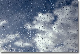
Drizzle is precipitation in the form of water droplets which are
smaller than raindrops.
Drizzle is characterized by fine, gently falling droplets and typically does not
impact human habitation in a negative way. The exception to this is freezing drizzle,
a condition where drizzle freezes immediately upon reaching earth's surface.
Freezing drizzle is still less dangerous than freezing rain, but can
potentially result in hazardous road conditions.
Next Topic: Evaporation
Current conditions powered by WeatherAPI.com


