Weather Alert in Arizona
Flood Advisory issued August 26 at 12:44AM PDT until August 26 at 2:30AM PDT by NWS Las Vegas NV
AREAS AFFECTED: Mohave, AZ
DESCRIPTION: * WHAT...Flooding caused by excessive rainfall continues. * WHERE...A portion of northwest Arizona, including the following county, Mohave. * WHEN...Until 230 AM MST. * IMPACTS...Minor flooding in low-lying and poor drainage areas. * ADDITIONAL DETAILS... - At 1244 AM MST, Doppler radar indicated rain tapering off over eastern Mohave County. Minor flooding may still be ongoing in the advisory area. - Some locations that will experience flooding include... Wikieup, Valentine, Diamond M Ranch, Diamond Creek Campground, Blake Ranch Road, Dw Ranch Road, Hualapai Mountain Park, Wild Cow Campground, Grand Canyon Skywalk, Bar Ten Ranch, Toroweap Campground, Burro Creek Campground, Mt. Trumbull, Peach Springs and Tuweep. - This includes the following highways... Interstate 40 in Arizona between mile markers 61 and 93. the Colorado River between mile markers 169 and 268. - http://www.weather.gov/safety/flood
INSTRUCTION: Turn around, don't drown when encountering flooded roads. Most flood deaths occur in vehicles.
Want more detail? Get the Complete 7 Day and Night Detailed Forecast!
Current U.S. National Radar--Current
The Current National Weather Radar is shown below with a UTC Time (subtract 5 hours from UTC to get Eastern Time).

National Weather Forecast--Current
The Current National Weather Forecast and National Weather Map are shown below.

National Weather Forecast for Tomorrow
Tomorrow National Weather Forecast and Tomorrow National Weather Map are show below.

North America Water Vapor (Moisture)
This map shows recent moisture content over North America. Bright and colored areas show high moisture (ie, clouds); brown indicates very little moisture present; black indicates no moisture.

Weather Topic: What is Snow?
Home - Education - Precipitation - Snow
 Next Topic: Stratocumulus Clouds
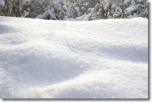
Snow is precipitation taking the form of ice crystals. Each ice crystal, or snowflake,
has unique characteristics, but all of them grow in a hexagonal structure.
Snowfall can last for sustained periods of time and result in significant buildup
of snow on the ground.
On the earth's surface, snow starts out light and powdery, but as it begins to melt
it tends to become more granular, producing small bits of ice which have the consistency of
sand. After several cycles of melting and freezing, snow can become very dense
and ice-like, commonly known as snow pack.
Next Topic: Stratocumulus Clouds
Weather Topic: What are Stratus Clouds?
Home - Education - Cloud Types - Stratus Clouds
 Next Topic: Wall Clouds
Stratus clouds are similar to altostratus clouds, but form at a
lower altitude and are identified by their fog-like appearance, lacking the
distinguishing features of most clouds.
Stratus clouds are wider than most clouds, and their base has a smooth, uniform
look which is lighter in color than a nimbostratus cloud.
The presence of a stratus cloud indicates the possibility of minor precipitation,
such as drizzle, but heavier precipitation does not typically arrive in the form
of a stratus cloud.
Next Topic: Wall Clouds
Current conditions powered by WeatherAPI.com


