Weather Alert in Arkansas
Flood Warning issued April 23 at 9:26PM CDT until April 27 at 5:00AM CDT by NWS Memphis TN
AREAS AFFECTED: Lee, AR; Phillips, AR; Coahoma, MS; Tunica, MS
DESCRIPTION: ...The Flood Warning continues for the following rivers in Arkansas...Mississippi...Tennessee...Missouri... Mississippi River at Helena Mississippi River at Memphis Mississippi River at Tunica Mhoon Landing Mississippi River Above Tiptonville Mississippi River at Caruthersville Mississippi River at Osceola For the Lower Mississippi River...including Tiptonville, Caruthersville, Osceola, Memphis, Tunica Mhoon Landing, Helena... Moderate flooding is forecast. * WHAT...Minor flooding is occurring and minor flooding is forecast. * WHERE...Mississippi River at Helena. * WHEN...Until early Sunday morning. * IMPACTS...At 46.0 feet, In Mississippi, houses at Robson Towhead are being flooded. The settlement by Old River Chutes is going underwater. All locations on the northeast side of Desoto Lake are underwater. * ADDITIONAL DETAILS... - At 9:00 PM CDT Wednesday the stage was 45.7 feet. - Recent Activity...The maximum river stage in the 24 hours ending at 9:00 PM CDT Wednesday was 46.1 feet. - Forecast...The river is expected to fall below flood stage early Saturday morning. - Flood stage is 44.0 feet. - http://www.weather.gov/safety/flood
INSTRUCTION: Motorists should not attempt to drive around barricades or drive cars through flooded areas. Caution is urged when walking near riverbanks. Additional information is available at weather.gov/memphis. The next statement will be issued as needed.
Want more detail? Get the Complete 7 Day and Night Detailed Forecast!
Current U.S. National Radar--Current
The Current National Weather Radar is shown below with a UTC Time (subtract 5 hours from UTC to get Eastern Time).

National Weather Forecast--Current
The Current National Weather Forecast and National Weather Map are shown below.

National Weather Forecast for Tomorrow
Tomorrow National Weather Forecast and Tomorrow National Weather Map are show below.

North America Water Vapor (Moisture)
This map shows recent moisture content over North America. Bright and colored areas show high moisture (ie, clouds); brown indicates very little moisture present; black indicates no moisture.

Weather Topic: What are Cumulonimbus Clouds?
Home - Education - Cloud Types - Cumulonimbus Clouds
 Next Topic: Cumulus Clouds
The final form taken by a growing cumulus cloud is the
cumulonimbus cloud, which is very tall and dense.
The tower of a cumulonimbus cloud can soar 23 km into the atmosphere, although
most commonly they stop growing at an altitude of 6 km.
Even small cumulonimbus clouds appear very large in comparison to other cloud types.
They can signal the approach of stormy weather, such as thunderstorms or blizzards.
Next Topic: Cumulus Clouds
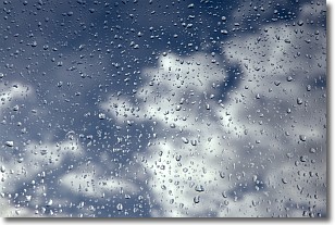
Weather Topic: What is Drizzle?
Home - Education - Precipitation - Drizzle
 Next Topic: Evaporation
Drizzle is precipitation in the form of water droplets which are
smaller than raindrops.
Drizzle is characterized by fine, gently falling droplets and typically does not
impact human habitation in a negative way. The exception to this is freezing drizzle,
a condition where drizzle freezes immediately upon reaching earth's surface.
Freezing drizzle is still less dangerous than freezing rain, but can
potentially result in hazardous road conditions.
Next Topic: Evaporation
Current conditions powered by WeatherAPI.com


