Weather Alert in Michigan
Hydrologic Outlook issued February 17 at 9:43AM EST by NWS Grand Rapids MI
AREAS AFFECTED: Allegan, MI; Barry, MI; Calhoun, MI; Clinton, MI; Eaton, MI; Ingham, MI; Ionia, MI; Jackson, MI; Kalamazoo, MI; Kent, MI; Muskegon, MI; Ottawa, MI; Van Buren, MI
DESCRIPTION: ESFGRR Steady melting of snow and ice over the last week has begun to cause rivers to rise across the area. Several chances for rain this week will add to these rises. Based on current expected rainfall, no significant flooding is expected on West Michigan rivers, though typical spring water level rises within the river channels will happen. Meanwhile, river ice has weakened significantly over the last week, and as water levels rise any remaining ice will likely be broken and start to move downstream. This creates the possibility for formation of a few ice jams. Ice jams tend to form in the same places repeatedly, so special attention should be paid in the Comstock Park (Kent County) area as well as the Robinson Township (Ottawa County) area along the Grand River. Anyone living or working near West Michigan rivers should pay extra attention this week as water levels rise. Have a plan to monitor and respond if flooding develops unexpectedly. Monitor the latest conditions at https://water.noaa.gov
INSTRUCTION: N/A
Want more detail? Get the Complete 7 Day and Night Detailed Forecast!
Current U.S. National Radar--Current
The Current National Weather Radar is shown below with a UTC Time (subtract 5 hours from UTC to get Eastern Time).

National Weather Forecast--Current
The Current National Weather Forecast and National Weather Map are shown below.

National Weather Forecast for Tomorrow
Tomorrow National Weather Forecast and Tomorrow National Weather Map are show below.

North America Water Vapor (Moisture)
This map shows recent moisture content over North America. Bright and colored areas show high moisture (ie, clouds); brown indicates very little moisture present; black indicates no moisture.

Weather Topic: What are Cumulonimbus Clouds?
Home - Education - Cloud Types - Cumulonimbus Clouds
 Next Topic: Cumulus Clouds
The final form taken by a growing cumulus cloud is the
cumulonimbus cloud, which is very tall and dense.
The tower of a cumulonimbus cloud can soar 23 km into the atmosphere, although
most commonly they stop growing at an altitude of 6 km.
Even small cumulonimbus clouds appear very large in comparison to other cloud types.
They can signal the approach of stormy weather, such as thunderstorms or blizzards.
Next Topic: Cumulus Clouds
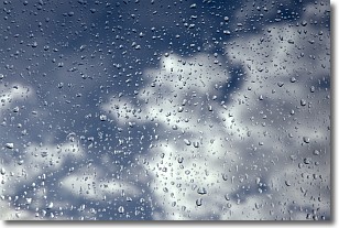
Weather Topic: What is Drizzle?
Home - Education - Precipitation - Drizzle
 Next Topic: Evaporation
Drizzle is precipitation in the form of water droplets which are
smaller than raindrops.
Drizzle is characterized by fine, gently falling droplets and typically does not
impact human habitation in a negative way. The exception to this is freezing drizzle,
a condition where drizzle freezes immediately upon reaching earth's surface.
Freezing drizzle is still less dangerous than freezing rain, but can
potentially result in hazardous road conditions.
Next Topic: Evaporation
Current conditions powered by WeatherAPI.com


