Weather Alert in Texas
Special Weather Statement issued September 5 at 8:29PM CDT by NWS Fort Worth TX
AREAS AFFECTED: Fannin; Lamar; Collin; Hunt; Delta
DESCRIPTION: At 828 PM CDT, Doppler radar was tracking strong thunderstorms along a line extending from near Bonham to Blue Ridge. Movement was east at 40 mph. HAZARD...Wind gusts of 50 to 55 mph and nickel size hail. SOURCE...Radar indicated. IMPACT...Gusty winds could knock down tree limbs and blow around unsecured objects. Minor damage to outdoor objects is possible. Strong thunderstorms will be near... Honey Grove, Crockett Lake, and Coffee Mill Lake around 835 PM CDT. Roxton and Big Creek Lake around 850 PM CDT. Paris, Cooper, Sumner, and Lake Gibbons around 855 PM CDT. Lake Crook and Pat Mayse Lake around 900 PM CDT. Reno and Camp Maxey around 905 PM CDT. Powderly around 910 PM CDT. Blossom, Arthur City, and Pattonville around 915 PM CDT. Other locations impacted by these storms include Charleston, Lake Creek, Pacio, Nobility, Direct, Midcity, Forest Hill, Ely, Taylor Town, and Sun Valley.
INSTRUCTION: Frequent cloud to ground lightning is occurring with these storms. Lightning can strike 10 miles away from a thunderstorm. Seek a safe shelter inside a building or vehicle.
Want more detail? Get the Complete 7 Day and Night Detailed Forecast!
Current U.S. National Radar--Current
The Current National Weather Radar is shown below with a UTC Time (subtract 5 hours from UTC to get Eastern Time).

National Weather Forecast--Current
The Current National Weather Forecast and National Weather Map are shown below.

National Weather Forecast for Tomorrow
Tomorrow National Weather Forecast and Tomorrow National Weather Map are show below.

North America Water Vapor (Moisture)
This map shows recent moisture content over North America. Bright and colored areas show high moisture (ie, clouds); brown indicates very little moisture present; black indicates no moisture.

Weather Topic: What are Nimbostratus Clouds?
Home - Education - Cloud Types - Nimbostratus Clouds
 Next Topic: Precipitation
A nimbostratus cloud is similar to a stratus cloud in its formless,
smooth appearance. However, a nimbostratus cloud is darker than a stratus cloud,
because it is thicker.
Unlike a stratus cloud, a nimbostratus cloud typically brings with it the threat
of moderate to heavy precipitation. In some cases, the precipitation may evaporate
before reaching the ground, a phenomenon known as virga.
Next Topic: Precipitation
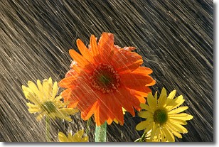
Weather Topic: What is Rain?
Home - Education - Precipitation - Rain
 Next Topic: Shelf Clouds
Precipitation in the form of water droplets is called rain.
Rain generally has a tendency to fall with less intensity over a greater period
of time, and when rainfall is more severe it is usually less sustained.
Rain is the most common form of precipitation and happens with greater frequency
depending on the season and regional influences. Cities have been shown to have
an observable effect on rainfall, due to an effect called the urban heat island.
Compared to upwind, monthly rainfall between twenty and forty miles downwind of
cities is 30% greater.
Next Topic: Shelf Clouds
Current conditions powered by WeatherAPI.com


