Weather Alert in New York
Extreme Cold Watch issued February 5 at 1:01AM EST until February 8 at 1:00PM EST by NWS Buffalo NY
AREAS AFFECTED: Oswego; Jefferson; Lewis
DESCRIPTION: * WHAT...Dangerously cold wind chills as low as 35 below zero possible. * WHERE...The Eastern Lake Ontario Region. * WHEN...From Saturday morning through Sunday afternoon. * IMPACTS...Dangerously cold wind chills as low as 35 below zero could cause frostbite on exposed skin in as little as 15 minutes.
INSTRUCTION: This is a potentially dangerous situation to be outdoors. If you must be outside, be sure to cover all exposed skin. Frostbite can occur in 15 minutes or less with apparent temperatures of 25 below zero or colder.
Want more detail? Get the Complete 7 Day and Night Detailed Forecast!
Current U.S. National Radar--Current
The Current National Weather Radar is shown below with a UTC Time (subtract 5 hours from UTC to get Eastern Time).

National Weather Forecast--Current
The Current National Weather Forecast and National Weather Map are shown below.

National Weather Forecast for Tomorrow
Tomorrow National Weather Forecast and Tomorrow National Weather Map are show below.

North America Water Vapor (Moisture)
This map shows recent moisture content over North America. Bright and colored areas show high moisture (ie, clouds); brown indicates very little moisture present; black indicates no moisture.

Weather Topic: What is Drizzle?
Home - Education - Precipitation - Drizzle
 Next Topic: Evaporation
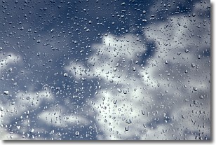
Drizzle is precipitation in the form of water droplets which are
smaller than raindrops.
Drizzle is characterized by fine, gently falling droplets and typically does not
impact human habitation in a negative way. The exception to this is freezing drizzle,
a condition where drizzle freezes immediately upon reaching earth's surface.
Freezing drizzle is still less dangerous than freezing rain, but can
potentially result in hazardous road conditions.
Next Topic: Evaporation
Weather Topic: What is Fog?
Home - Education - Cloud Types - Fog
 Next Topic: Fractus Clouds
Fog is technically a type of stratus cloud, which lies along the
ground and obscures visibility.
It is usually created when humidity in the air condenses into tiny water droplets.
Because of this, some places are more prone to foggy weather, such as regions
close to a body of water.
Fog is similar to mist; both are the appearance of water droplets suspended in
the air, but fog is the term applied to the condition when visibility is less than 1 km.
Next Topic: Fractus Clouds
Current conditions powered by WeatherAPI.com


