Weather Alert in Arkansas
Flood Warning issued April 23 at 8:44PM CDT until May 4 at 9:24AM CDT by NWS Jackson MS
AREAS AFFECTED: Chicot, AR; East Carroll, LA; Issaquena, MS; Washington, MS
DESCRIPTION: ...The Flood Warning continues for the following rivers in Louisiana...Mississippi...Arkansas... Mississippi River At Vicksburg affecting Jefferson, Madison, Tensas, Claiborne and Warren Counties. Mississippi River At Natchez affecting Concordia, Wilkinson and Adams Counties. Mississippi River Near Greenville affecting Washington, Issaquena, East Carroll and Chicot Counties. Mississippi River Near Arkansas City affecting Washington, Bolivar, Desha and Chicot Counties. * WHAT...Moderate flooding is occurring and moderate flooding is forecast. * WHERE...Mississippi River near Greenville. * WHEN...Until Sunday, May 04. * IMPACTS...At 55.0 feet, Practically all areas between levees are flooded. Approximately 50 buildings have water inside them. Water enters Farmers Grain terminal building north of the Greenville bridge. Electric power is turned off to north and south Lake Ferguson Road and Hillman-Logan Road. * ADDITIONAL DETAILS... - At 8:00 PM CDT Wednesday the stage was 54.3 feet. - Forecast...The river is expected to rise to a crest of 54.8 feet Sunday morning. - Flood stage is 48.0 feet.
INSTRUCTION: Motorists should not attempt to drive around barricades or drive cars through flooded areas. Turn around, don't drown when encountering flooded roads. Most flood deaths occur in vehicles. Additional information is available at www.water.noaa.gov/wfo/jan The next statement will be issued Thursday morning at 845 AM CDT.
Want more detail? Get the Complete 7 Day and Night Detailed Forecast!
Current U.S. National Radar--Current
The Current National Weather Radar is shown below with a UTC Time (subtract 5 hours from UTC to get Eastern Time).

National Weather Forecast--Current
The Current National Weather Forecast and National Weather Map are shown below.

National Weather Forecast for Tomorrow
Tomorrow National Weather Forecast and Tomorrow National Weather Map are show below.

North America Water Vapor (Moisture)
This map shows recent moisture content over North America. Bright and colored areas show high moisture (ie, clouds); brown indicates very little moisture present; black indicates no moisture.

Weather Topic: What is Snow?
Home - Education - Precipitation - Snow
 Next Topic: Stratocumulus Clouds
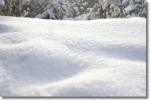
Snow is precipitation taking the form of ice crystals. Each ice crystal, or snowflake,
has unique characteristics, but all of them grow in a hexagonal structure.
Snowfall can last for sustained periods of time and result in significant buildup
of snow on the ground.
On the earth's surface, snow starts out light and powdery, but as it begins to melt
it tends to become more granular, producing small bits of ice which have the consistency of
sand. After several cycles of melting and freezing, snow can become very dense
and ice-like, commonly known as snow pack.
Next Topic: Stratocumulus Clouds
Weather Topic: What are Stratus Clouds?
Home - Education - Cloud Types - Stratus Clouds
 Next Topic: Wall Clouds
Stratus clouds are similar to altostratus clouds, but form at a
lower altitude and are identified by their fog-like appearance, lacking the
distinguishing features of most clouds.
Stratus clouds are wider than most clouds, and their base has a smooth, uniform
look which is lighter in color than a nimbostratus cloud.
The presence of a stratus cloud indicates the possibility of minor precipitation,
such as drizzle, but heavier precipitation does not typically arrive in the form
of a stratus cloud.
Next Topic: Wall Clouds
Current conditions powered by WeatherAPI.com


