Weather Alert in New Mexico
Red Flag Warning issued February 17 at 8:36PM CST until February 18 at 8:00PM CST by NWS Midland/Odessa TX
AREAS AFFECTED: Chaves County Plains; Eddy Plains; Lea; Gaines; Loving; Van Horn and Highway 54 Corridor; Eastern Culberson County; Reeves County Plains; Chinati Mountains; Marfa Plateau; Davis Mountains; Davis Mountains Foothills
DESCRIPTION: ...RED FLAG WARNING IN EFFECT FROM WEDNESDAY AFTERNOON AND EVENING FOR 20 FOOT WINDS OF 20 MPH OR GREATER, RELATIVE HUMIDITY AT OR BELOW 15 PERCENT, AND VERY HIGH FIRE DANGER ACROSS GAINES COUNTY, THE SOUTHEAST NEW MEXICO PLAINS, UPPER TRANS PECOS, VAN HORN CORRIDOR, DAVIS MOUNTAINS, AND MARFA PLATEAU... * WINDS...Southwest 25 to 35 mph with gusts up to 55 mph. * RELATIVE HUMIDITY...As low as 10 percent. * RFTI...6 or critical. * IMPACTS...Any fires that develop will likely spread rapidly. Outdoor burning is not recommended. * SEVERITY... FUELS (ERC)...50th-69th percentile...3 (out of 5). WEATHER...Near Critical...2 (out of 5). FIRE ENVIRONMENT...5 (out of 10).
INSTRUCTION: A Red Flag Warning means that critical fire weather conditions are either occurring now or will shortly. A combination of strong winds, low relative humidity and warm temperatures will increase potential for fire growth.
Want more detail? Get the Complete 7 Day and Night Detailed Forecast!
Current U.S. National Radar--Current
The Current National Weather Radar is shown below with a UTC Time (subtract 5 hours from UTC to get Eastern Time).

National Weather Forecast--Current
The Current National Weather Forecast and National Weather Map are shown below.

National Weather Forecast for Tomorrow
Tomorrow National Weather Forecast and Tomorrow National Weather Map are show below.

North America Water Vapor (Moisture)
This map shows recent moisture content over North America. Bright and colored areas show high moisture (ie, clouds); brown indicates very little moisture present; black indicates no moisture.

Weather Topic: What are Cumulonimbus Clouds?
Home - Education - Cloud Types - Cumulonimbus Clouds
 Next Topic: Cumulus Clouds
The final form taken by a growing cumulus cloud is the
cumulonimbus cloud, which is very tall and dense.
The tower of a cumulonimbus cloud can soar 23 km into the atmosphere, although
most commonly they stop growing at an altitude of 6 km.
Even small cumulonimbus clouds appear very large in comparison to other cloud types.
They can signal the approach of stormy weather, such as thunderstorms or blizzards.
Next Topic: Cumulus Clouds
Weather Topic: What is Drizzle?
Home - Education - Precipitation - Drizzle
 Next Topic: Evaporation
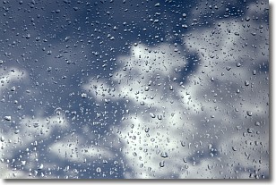
Drizzle is precipitation in the form of water droplets which are
smaller than raindrops.
Drizzle is characterized by fine, gently falling droplets and typically does not
impact human habitation in a negative way. The exception to this is freezing drizzle,
a condition where drizzle freezes immediately upon reaching earth's surface.
Freezing drizzle is still less dangerous than freezing rain, but can
potentially result in hazardous road conditions.
Next Topic: Evaporation
Current conditions powered by WeatherAPI.com


