Weather Alert in Wisconsin
Severe Thunderstorm Warning issued April 2 at 7:45PM CDT until April 2 at 8:15PM CDT by NWS Milwaukee/Sullivan WI
AREAS AFFECTED: Milwaukee, WI; Ozaukee, WI; Washington, WI; Waukesha, WI
DESCRIPTION: SVRMKX The National Weather Service in Milwaukee/Sullivan has issued a * Severe Thunderstorm Warning for... Ozaukee County in southeastern Wisconsin... Milwaukee County in southeastern Wisconsin... Eastern Waukesha County in southeastern Wisconsin... Southeastern Washington County in southeastern Wisconsin... * Until 815 PM CDT. * At 745 PM CDT, severe thunderstorms were located along a line extending from near Cedarburg to Butler to near New Berlin, moving northeast at 60 mph. HAZARD...60 mph wind gusts. SOURCE...Radar indicated. IMPACT...Expect damage to roofs, siding, and trees. * Locations impacted include... Milwaukee, Waukesha, West Allis, Wauwatosa, New Berlin, Brookfield, Greenfield, Menomonee Falls, Muskego, Mequon, Cudahy, Whitefish Bay, Greendale, Pewaukee, Brown Deer, Grafton, Cedarburg, Port Washington, Sussex, and St. Francis. Other landmarks included are the following Locations Schlitz Audobon Nature Center, Boerner Botanical Gardens, General Mitchell International Airport, Timmerman Airport, Froedert & the Medical College, and Fiserv Forum.
INSTRUCTION: For your protection move to an interior room on the lowest floor of a building. A Tornado Watch remains in effect until 1100 PM CDT for southeastern Wisconsin.
Want more detail? Get the Complete 7 Day and Night Detailed Forecast!
Current U.S. National Radar--Current
The Current National Weather Radar is shown below with a UTC Time (subtract 5 hours from UTC to get Eastern Time).

National Weather Forecast--Current
The Current National Weather Forecast and National Weather Map are shown below.

National Weather Forecast for Tomorrow
Tomorrow National Weather Forecast and Tomorrow National Weather Map are show below.

North America Water Vapor (Moisture)
This map shows recent moisture content over North America. Bright and colored areas show high moisture (ie, clouds); brown indicates very little moisture present; black indicates no moisture.

Weather Topic: What are Nimbostratus Clouds?
Home - Education - Cloud Types - Nimbostratus Clouds
 Next Topic: Precipitation
A nimbostratus cloud is similar to a stratus cloud in its formless,
smooth appearance. However, a nimbostratus cloud is darker than a stratus cloud,
because it is thicker.
Unlike a stratus cloud, a nimbostratus cloud typically brings with it the threat
of moderate to heavy precipitation. In some cases, the precipitation may evaporate
before reaching the ground, a phenomenon known as virga.
Next Topic: Precipitation
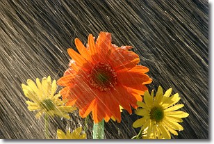
Weather Topic: What is Rain?
Home - Education - Precipitation - Rain
 Next Topic: Shelf Clouds
Precipitation in the form of water droplets is called rain.
Rain generally has a tendency to fall with less intensity over a greater period
of time, and when rainfall is more severe it is usually less sustained.
Rain is the most common form of precipitation and happens with greater frequency
depending on the season and regional influences. Cities have been shown to have
an observable effect on rainfall, due to an effect called the urban heat island.
Compared to upwind, monthly rainfall between twenty and forty miles downwind of
cities is 30% greater.
Next Topic: Shelf Clouds
Current conditions powered by WeatherAPI.com


