Weather Alert in Oklahoma
Flood Advisory issued August 26 at 7:52PM CDT until August 27 at 1:00PM CDT by NWS Norman OK
AREAS AFFECTED: Blaine, OK; Caddo, OK; Canadian, OK; Grady, OK
DESCRIPTION: ...The Flood Advisory continues for the following rivers in Oklahoma... Canadian River near Bridgeport affecting Grady, Caddo, Blaine and Canadian Counties. * WHAT...Flooding caused by excessive rainfall continues. * WHERE...Canadian River near Bridgeport. * WHEN...Until early tomorrow afternoon. * IMPACTS...At 12.0 feet, The river remains within its banks in southern Blaine... northern Caddo... and southwestern Canadian counties. Low-lying bottomlands near the river may be cut off from easy access by high water in side channels. * ADDITIONAL DETAILS... - There is no current observed data. The estimated stage is 11.8 feet. - Bankfull stage is 14.0 feet. - Forecast...The Canadian River is expect to rise to 12.1 feet just after midnight then is expected to fall. - Action stage is 12.0 feet. - Flood stage is 14.0 feet. - http://www.weather.gov/safety/flood
INSTRUCTION: If you encounter a flooded roadway, turn around and find an alternative route. Additional information is available at www.weather.gov.
Want more detail? Get the Complete 7 Day and Night Detailed Forecast!
Current U.S. National Radar--Current
The Current National Weather Radar is shown below with a UTC Time (subtract 5 hours from UTC to get Eastern Time).

National Weather Forecast--Current
The Current National Weather Forecast and National Weather Map are shown below.

National Weather Forecast for Tomorrow
Tomorrow National Weather Forecast and Tomorrow National Weather Map are show below.

North America Water Vapor (Moisture)
This map shows recent moisture content over North America. Bright and colored areas show high moisture (ie, clouds); brown indicates very little moisture present; black indicates no moisture.

Weather Topic: What are Cumulonimbus Clouds?
Home - Education - Cloud Types - Cumulonimbus Clouds
 Next Topic: Cumulus Clouds
The final form taken by a growing cumulus cloud is the
cumulonimbus cloud, which is very tall and dense.
The tower of a cumulonimbus cloud can soar 23 km into the atmosphere, although
most commonly they stop growing at an altitude of 6 km.
Even small cumulonimbus clouds appear very large in comparison to other cloud types.
They can signal the approach of stormy weather, such as thunderstorms or blizzards.
Next Topic: Cumulus Clouds
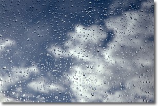
Weather Topic: What is Drizzle?
Home - Education - Precipitation - Drizzle
 Next Topic: Evaporation
Drizzle is precipitation in the form of water droplets which are
smaller than raindrops.
Drizzle is characterized by fine, gently falling droplets and typically does not
impact human habitation in a negative way. The exception to this is freezing drizzle,
a condition where drizzle freezes immediately upon reaching earth's surface.
Freezing drizzle is still less dangerous than freezing rain, but can
potentially result in hazardous road conditions.
Next Topic: Evaporation
Current conditions powered by WeatherAPI.com


