Weather Alert in North Carolina
High Surf Advisory issued August 21 at 9:50AM EDT until August 22 at 7:00AM EDT by NWS Wakefield VA
AREAS AFFECTED: Eastern Currituck; Virginia Beach
DESCRIPTION: * WHAT...For the Beach Hazards Statement, a high risk of rip currents is expected. For the High Surf Advisory, large breaking waves of 8 to 12 feet expected in the surf zone. For the Coastal Flood Warning, one to three feet of inundation above ground level possible in low-lying areas near shorelines and tidal waterways. * WHERE...In North Carolina, Eastern Currituck County. In Virginia, Virginia Beach. * WHEN...For the Coastal Flood Warning, until 2 PM EDT Friday. For the High Surf Advisory, until 7 AM EDT Friday. For the Beach Hazards Statement, through Friday evening. * IMPACTS...Numerous roads may be closed. Low lying property including homes, businesses, and some critical infrastructure may be inundated. Very dangerous swimming and surfing conditions are expected, as well as the wave action resulting in significant beach erosion. Rip currents can sweep even the best swimmers away from shore into deeper water. Dangerous shore break can throw a swimmer or surfer head first into the bottom causing neck and back injuries.
INSTRUCTION: Take the necessary actions to protect flood-prone property. If travel is required, do not drive around barricades or through water of unknown depth. Inexperienced swimmers should remain out of the water due to dangerous surf conditions. Remain out of the water to avoid hazardous swimming conditions.
Want more detail? Get the Complete 7 Day and Night Detailed Forecast!
Current U.S. National Radar--Current
The Current National Weather Radar is shown below with a UTC Time (subtract 5 hours from UTC to get Eastern Time).

National Weather Forecast--Current
The Current National Weather Forecast and National Weather Map are shown below.

National Weather Forecast for Tomorrow
Tomorrow National Weather Forecast and Tomorrow National Weather Map are show below.

North America Water Vapor (Moisture)
This map shows recent moisture content over North America. Bright and colored areas show high moisture (ie, clouds); brown indicates very little moisture present; black indicates no moisture.

Weather Topic: What is Condensation?
Home - Education - Precipitation - Condensation
 Next Topic: Contrails
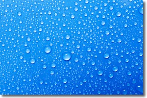
Condensation is the process which creates clouds, and therefore
it is a crucial process in the water cycle.
Condensation is the change of matter from a state of gas into a state of liquid,
and it happens because water molecules release heat into the atmosphere and
become organized into a more closely packed structure, what we might see as
water droplets.
Water is always present in the air around us as a vapor, but it's too small for
us to see. When water undergoes the process of condensation it becomes organized
into visible water droplets. You've probably seen condensation happen before on the
surface of a cold drink!
Next Topic: Contrails
Weather Topic: What are Cumulonimbus Clouds?
Home - Education - Cloud Types - Cumulonimbus Clouds
 Next Topic: Cumulus Clouds
The final form taken by a growing cumulus cloud is the
cumulonimbus cloud, which is very tall and dense.
The tower of a cumulonimbus cloud can soar 23 km into the atmosphere, although
most commonly they stop growing at an altitude of 6 km.
Even small cumulonimbus clouds appear very large in comparison to other cloud types.
They can signal the approach of stormy weather, such as thunderstorms or blizzards.
Next Topic: Cumulus Clouds
Current conditions powered by WeatherAPI.com


