Weather Alert in New Mexico
Winter Weather Advisory issued February 18 at 11:21AM MST until February 18 at 11:00PM MST by NWS Albuquerque NM
AREAS AFFECTED: Chuska Mountains; Tusas Mountains Including Chama
DESCRIPTION: * WHAT...Snow expected. Total snow accumulations 2 to 6 inches except up to 9 inches above 8500 feet. Winds gusting as high as 55 mph. * WHERE...Tusas Mountains Including Chama and the Chuska Mountains. * WHEN...Until 11 PM MST this evening. * IMPACTS...Travel could be very difficult. Tire chains may be necessary if traveling through mountain passes. Areas of blowing snow could significantly reduce visibility. Very strong winds could cause extensive damage to trees and power lines. * ADDITIONAL DETAILS...The heaviest snow is forecast for late afternoon in the Chuska Mountains, and this afternoon and evening in the Tusas Mountains, as a cold front crosses from the northwest. Visibility will drop below a half mile at times during periods of snow and blowing snow.
INSTRUCTION: Slow down and use caution while traveling. For the latest road conditions, dial 511 or 1.800.432.4269, or visit http://nmroads.com.
Want more detail? Get the Complete 7 Day and Night Detailed Forecast!
Current U.S. National Radar--Current
The Current National Weather Radar is shown below with a UTC Time (subtract 5 hours from UTC to get Eastern Time).

National Weather Forecast--Current
The Current National Weather Forecast and National Weather Map are shown below.

National Weather Forecast for Tomorrow
Tomorrow National Weather Forecast and Tomorrow National Weather Map are show below.

North America Water Vapor (Moisture)
This map shows recent moisture content over North America. Bright and colored areas show high moisture (ie, clouds); brown indicates very little moisture present; black indicates no moisture.

Weather Topic: What are Cumulonimbus Clouds?
Home - Education - Cloud Types - Cumulonimbus Clouds
 Next Topic: Cumulus Clouds
The final form taken by a growing cumulus cloud is the
cumulonimbus cloud, which is very tall and dense.
The tower of a cumulonimbus cloud can soar 23 km into the atmosphere, although
most commonly they stop growing at an altitude of 6 km.
Even small cumulonimbus clouds appear very large in comparison to other cloud types.
They can signal the approach of stormy weather, such as thunderstorms or blizzards.
Next Topic: Cumulus Clouds
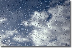
Weather Topic: What is Drizzle?
Home - Education - Precipitation - Drizzle
 Next Topic: Evaporation
Drizzle is precipitation in the form of water droplets which are
smaller than raindrops.
Drizzle is characterized by fine, gently falling droplets and typically does not
impact human habitation in a negative way. The exception to this is freezing drizzle,
a condition where drizzle freezes immediately upon reaching earth's surface.
Freezing drizzle is still less dangerous than freezing rain, but can
potentially result in hazardous road conditions.
Next Topic: Evaporation
Current conditions powered by WeatherAPI.com


