Weather Alert in Minnesota
Air Quality Alert issued July 23 at 3:07PM CDT by NWS Grand Forks ND
AREAS AFFECTED: West Polk; Norman; Clay; Kittson; Roseau; Lake Of The Woods; West Marshall; East Marshall; North Beltrami; Pennington; Red Lake; East Polk; North Clearwater; South Beltrami; Mahnomen; South Clearwater; Hubbard; West Becker; East Becker; Wilkin; West Otter Tail; East Otter Tail; Wadena; Grant
DESCRIPTION: * WHAT...The Minnesota Pollution Control Agency has issued an Air Quality Alert for fine particulate pollution. The Air Quality Index (AQI) is expected to reach the Red or Unhealthy category. * WHERE...Northwest Minnesota. * WHEN...Until 11 PM CDT Friday. * IMPACTS...Some members of the general public may experience health effects. Sensitive groups, such as people with lung disease (including asthma), heart disease, and children and older adults, may experience health effects. * ADDITIONAL DETAILS...A band of heavy smoke from wildfires in Saskatchewan and Manitoba is moving south across northwest Minnesota on Wednesday. The smoke will remain over the northwest part of the state through the end of Wednesday, but by Thursday morning the smoke will reach southwest MN. Smoke will also move into the northeast and central portions of the state Thursday morning, and by Thursday afternoon smoke will reach east central and south central MN. Some uncertainty still remains regarding how far south the ground-level smoke will reach by Friday morning, when winds are expected to become southerly and push the smoke back to the north. Air quality should improve gradually from south to north beginning Friday afternoon, with improvement in fine particle levels below the alert threshold expected by the end of Friday.
INSTRUCTION: Sensitive groups, such as people with lung disease (including asthma), heart disease, and children and older adults, should avoid prolonged or heavy exertion. The general public should limit prolonged or heavy exertion. Reduce or eliminate activities that contribute to air pollution, such as outdoor burning, and use of residential wood burning devices. Reduce vehicle trips and vehicle idling as much as possible. Keep windows closed overnight to prevent smoke from getting indoors.
Want more detail? Get the Complete 7 Day and Night Detailed Forecast!
Current U.S. National Radar--Current
The Current National Weather Radar is shown below with a UTC Time (subtract 5 hours from UTC to get Eastern Time).

National Weather Forecast--Current
The Current National Weather Forecast and National Weather Map are shown below.

National Weather Forecast for Tomorrow
Tomorrow National Weather Forecast and Tomorrow National Weather Map are show below.

North America Water Vapor (Moisture)
This map shows recent moisture content over North America. Bright and colored areas show high moisture (ie, clouds); brown indicates very little moisture present; black indicates no moisture.

Weather Topic: What are Altostratus Clouds?
Home - Education - Cloud Types - Altostratus Clouds
 Next Topic: Cirrocumulus Clouds
Altostratus clouds form at mid to high-level altitudes
(between 2 and 7 km) and are created by a warm, stable air mass which causes
water vapor
to condense as it rise through the atmosphere. Usually altostratus clouds are
featureless sheets characterized by a uniform color.
In some cases, wind punching through the cloud formation may give it a waved
appearance, called altostratus undulatus. Altostratus clouds
are commonly seen with other cloud formations accompanying them.
Next Topic: Cirrocumulus Clouds
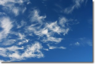
Weather Topic: What are Cirrostratus Clouds?
Home - Education - Cloud Types - Cirrostratus Clouds
 Next Topic: Cirrus Clouds
Cirrostratus clouds are high, thin clouds that form above
20,000 feet and are made mostly of ice crystals. They sometimes look like giant
feathers, horse tails, or curls of hair in the sky.
These clouds are pushed by the jet stream and can move at high speeds reaching
100 mph.
What do they indicate?
They indicate that a precipitation is likely within 24 hours.
Next Topic: Cirrus Clouds
Current conditions powered by WeatherAPI.com


