Weather Alert in Alaska
Winter Storm Watch issued February 27 at 3:19PM AKST until March 2 at 9:00AM AKST by NWS Juneau AK
AREAS AFFECTED: City and Borough of Wrangell
DESCRIPTION: ...CENTRAL AND SOUTHERN PANHANDLE SNOW SATURDAY WITH POTENTIAL FOR MORE SNOW SUNDAY... .Light scattered to numerous snow showers will pass over the region Friday night with accumulations of up to 2 inches. Through Saturday morning, a low will track across the central gulf and bring steady accumulating snow to the area with rates increasing through the afternoon. As the low center tracks eastward through Saturday afternoon and evening, south to southwest wind will cause temperatures to warm over the southern outer coast with a mix or change to rain. Snow will then end on the NW side of the low, from Sitka to Juneau northward. Moisture will decrease overnight Saturday across the south, but then redevelop on Sunday as another system moves in. The rain/snow line will likely hover in vicinity of Sumner Strait Sunday into Monday with potential additional heavy snow for the Petersburg and Wrangell areas and lighter snow northward. A separate low pressure system looks to affect the region on Tuesday with potential for snow to push northward again. * WHAT...For the Winter Storm Warning, heavy snow expected. Total snow accumulations of 6 to 10 inches. For the Winter Storm Watch, heavy snow possible. Additional snow accumulations of 6 to 12 inches possible. * WHERE...City and Borough of Wrangell. * WHEN...For the Winter Storm Warning, from 6 AM to 11 PM AKST Saturday. For the Winter Storm Watch, from Sunday morning through Monday morning. * IMPACTS...Travel will be difficult. * ADDITIONAL DETAILS...Heaviest snowfall rates on Saturday will be in the late afternoon and early evening.
INSTRUCTION: If you must travel, keep an extra flashlight, food, and water with you in case of an emergency. Monitor the latest forecasts for updates on this situation. People are urged to prepare their property before the onset of winter weather. For the latest road conditions, where available, call 5 1 1 or visit 511.alaska.gov.
Want more detail? Get the Complete 7 Day and Night Detailed Forecast!
Current U.S. National Radar--Current
The Current National Weather Radar is shown below with a UTC Time (subtract 5 hours from UTC to get Eastern Time).

National Weather Forecast--Current
The Current National Weather Forecast and National Weather Map are shown below.

National Weather Forecast for Tomorrow
Tomorrow National Weather Forecast and Tomorrow National Weather Map are show below.

North America Water Vapor (Moisture)
This map shows recent moisture content over North America. Bright and colored areas show high moisture (ie, clouds); brown indicates very little moisture present; black indicates no moisture.

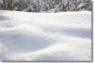
Weather Topic: What is Snow?
Home - Education - Precipitation - Snow
 Next Topic: Stratocumulus Clouds
Snow is precipitation taking the form of ice crystals. Each ice crystal, or snowflake,
has unique characteristics, but all of them grow in a hexagonal structure.
Snowfall can last for sustained periods of time and result in significant buildup
of snow on the ground.
On the earth's surface, snow starts out light and powdery, but as it begins to melt
it tends to become more granular, producing small bits of ice which have the consistency of
sand. After several cycles of melting and freezing, snow can become very dense
and ice-like, commonly known as snow pack.
Next Topic: Stratocumulus Clouds
Weather Topic: What are Stratus Clouds?
Home - Education - Cloud Types - Stratus Clouds
 Next Topic: Wall Clouds
Stratus clouds are similar to altostratus clouds, but form at a
lower altitude and are identified by their fog-like appearance, lacking the
distinguishing features of most clouds.
Stratus clouds are wider than most clouds, and their base has a smooth, uniform
look which is lighter in color than a nimbostratus cloud.
The presence of a stratus cloud indicates the possibility of minor precipitation,
such as drizzle, but heavier precipitation does not typically arrive in the form
of a stratus cloud.
Next Topic: Wall Clouds
Current conditions powered by WeatherAPI.com


