Weather Alert in Idaho
Flood Watch issued August 26 at 1:23PM MDT until August 28 at 12:00AM MDT by NWS Pocatello ID
AREAS AFFECTED: Shoshone/Lava Beds; Arco/Mud Lake Desert; Upper Snake River Plain; Lower Snake River Plain; Eastern Magic Valley; Southern Hills/Albion Mountains; Raft River Region; Marsh and Arbon Highlands; Franklin/Eastern Oneida Region; Bear River Range; Bear Lake Valley; Blackfoot Mountains; Caribou Range; Big Hole Mountains; Teton Valley; Centennial Mountains/Island Park; Beaverhead/Lemhi Highlands; Lost River Valleys; Lost River Range; Challis/Pahsimeroi Valleys; Frank Church Wilderness; Sun Valley Region; Big Lost Highlands/Copper Basin; Wood River Foothills
DESCRIPTION: A surge of deep monsoonal moisture will bring a prolonged period of rainfall across eastern Idaho which will result in widespread rainfall totals around 1 inch with locally higher amounts closer to 2 inches possible. This could result in areas of flooding within urban areas along with small creeks and streams. Additionally, there will be some potential for flash flooding, especially over recent burn scars. * WHAT...Flooding caused by excessive rainfall is possible. Flash flooding caused by excessive rainfall is also possible over area burn scars. * WHERE...Portions of central, eastern, south central, and southeast Idaho, including the following areas, in central Idaho, Big Lost Highlands/Copper Basin, Challis/Pahsimeroi Valleys, Frank Church Wilderness, Lost River Range, Lost River Valley, Sun Valley Region and Wood River Foothills. In eastern Idaho, Beaverhead - Lemhi Highlands, Big Hole Mountains, Centennial Mountains - Island Park and Teton Valley. In south central Idaho, Eastern Magic Valley and Shoshone/Lava Beds. In southeast Idaho, Arco/Mud Lake Desert, Bear Lake Valley, Bear River Range, Blackfoot Mountains, Caribou Range, Franklin/Eastern Oneida Region, Lower Snake River Plain, Marsh and Arbon Highlands, Raft River Region, Southern Hills/Albion Mountains and Upper Snake River Plain. * WHEN...Through Wednesday evening. * IMPACTS...Excessive runoff may result in flooding of rivers, creeks, streams, and other low-lying and flood-prone locations. Creeks and streams may rise out of their banks. In addition, flooding may occur in poor drainage and urban areas. * ADDITIONAL DETAILS... - http://www.weather.gov/safety/flood
INSTRUCTION: You should monitor later forecasts and be alert for possible Flood Warnings. Those living in areas prone to flooding should be prepared to take action should flooding develop.
Want more detail? Get the Complete 7 Day and Night Detailed Forecast!
Current U.S. National Radar--Current
The Current National Weather Radar is shown below with a UTC Time (subtract 5 hours from UTC to get Eastern Time).

National Weather Forecast--Current
The Current National Weather Forecast and National Weather Map are shown below.

National Weather Forecast for Tomorrow
Tomorrow National Weather Forecast and Tomorrow National Weather Map are show below.

North America Water Vapor (Moisture)
This map shows recent moisture content over North America. Bright and colored areas show high moisture (ie, clouds); brown indicates very little moisture present; black indicates no moisture.

Weather Topic: What are Nimbostratus Clouds?
Home - Education - Cloud Types - Nimbostratus Clouds
 Next Topic: Precipitation
A nimbostratus cloud is similar to a stratus cloud in its formless,
smooth appearance. However, a nimbostratus cloud is darker than a stratus cloud,
because it is thicker.
Unlike a stratus cloud, a nimbostratus cloud typically brings with it the threat
of moderate to heavy precipitation. In some cases, the precipitation may evaporate
before reaching the ground, a phenomenon known as virga.
Next Topic: Precipitation
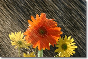
Weather Topic: What is Rain?
Home - Education - Precipitation - Rain
 Next Topic: Shelf Clouds
Precipitation in the form of water droplets is called rain.
Rain generally has a tendency to fall with less intensity over a greater period
of time, and when rainfall is more severe it is usually less sustained.
Rain is the most common form of precipitation and happens with greater frequency
depending on the season and regional influences. Cities have been shown to have
an observable effect on rainfall, due to an effect called the urban heat island.
Compared to upwind, monthly rainfall between twenty and forty miles downwind of
cities is 30% greater.
Next Topic: Shelf Clouds
Current conditions powered by WeatherAPI.com


